
Walking Tracks and Trails
There are easy walking trails and paths in the Newcastle area for you to explore and enjoy.
Bathers Way Walk
Stretching from the commanding lighthouse at Nobbys Headland to the coastal wilderness of Glenrock Reserve and the early coal workings at Burwood Beach, Newcastle's Bathers Way is a scenic 5 kilometre coastal walk waiting for you to discover, play, swim and eat any way you choose.
View the Bathers Way Walk map.
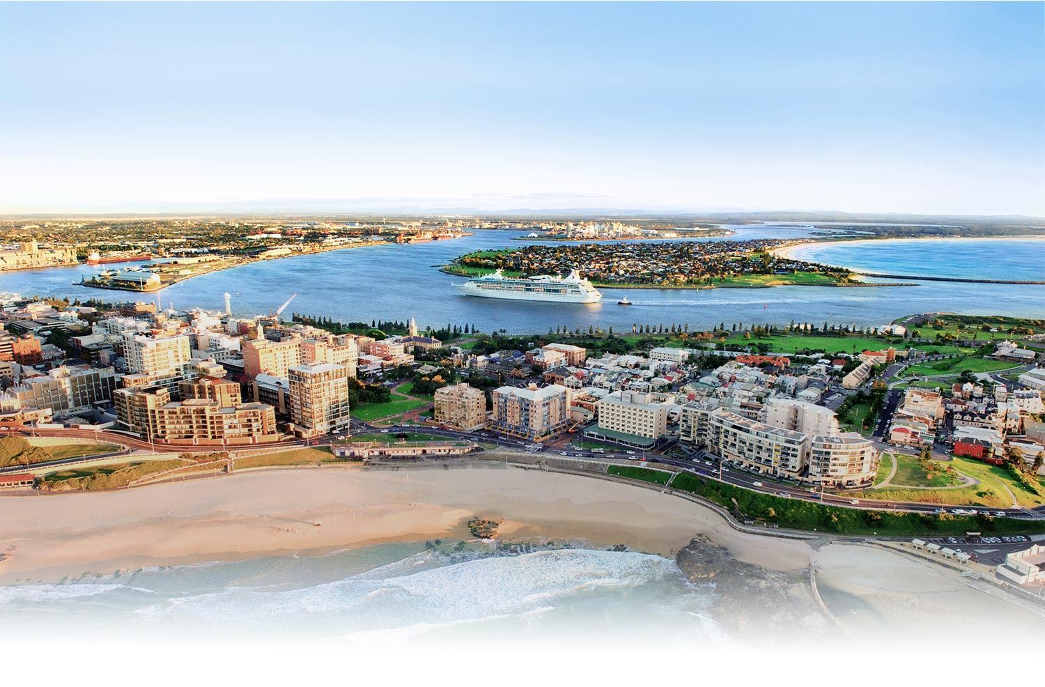
Anzac Memorial Walk
The ANZAC Memorial Walk is a stunning 450m tribute to the region's ANZAC's and the city's steel making heritage. The ANZAC Memorial Walk links the Bathers Way, a six km walking track that hugs the coastline, and is popular with active locals looking for fresh air.
Find out more about Memorial Walk or view the Anzac Memorial Walk map.
The Shoreline Walk
With its spectacular harbour and coastline, the Pacific Ocean has always played an important role in Novocastrian life.
This trail will allow you to explore the city through its relationship with the shoreline, visiting places that once formed a crucial part of Newcastle’s working harbour and maritime culture.
View the Shoreline Walk map.
Newcastle at War
Generations of Novocastrians experienced the impact of war on their lives and their city.
This walk lets you explore Newcastle through the conflicts that have shaped its landscape and character. Meet locals that left Newcastle to participate in some of the most devastating wars in history and walk in their footsteps, visiting places dedicated to their memory.
View the Newcastle at War map.
Newcastle Architecture Walk
The architecture of Newcastle showcases a rich diversity of styles that reflect the city’s prosperity and growth throughout the 19th and 20th centuries. On this tour you’ll explore buildings that have acted as cultural, political and economic icons for the people of Newcastle, and discover designs created by architects of local, national and international significance.
View the Newcastle Architecture Walk map.
Convict and Industry Walk
During this walk you will explore the city’s early years as a convict settlement. Visit remnants of the great industrial enterprises that once defined the city and discover amazing engineering feats that allowed the city and its people to prosper.
View the Convict and Industry Walk map.
Heritage Walk
Discover Newcastle's heritage buildings and environment at a leisurely pace by taking a heritage walk.
Find out more about Heritage Walks in Newcastle.
Artist's City Walk
Newcastle has nurtured, supported and inspired generations of artists.
On this tour you will explore the city through their eyes, visit the galleries that have displayed and celebrated their work and view examples of the extraordinary public art that populates the Newcastle landscape.
View the Artist's City Walk map.
Blackbutt Reserve
A popular nature reserve with over 20 kilometres of walking trails and native animal and bird life to observe. Find out more about Blackbutt Reserve
Fernleigh Track
The Fernleigh Track is an attractive and popular shared pathway along the route of a former rail line between Adamstown and Belmont. The paved, 15km gently graded track takes in coastal, wetland and bushland environments and is suitable for people of all fitness levels. It starts near Adamstown Station and passes through the suburbs of Kotara, Kahiba, Whitebridge, Redhead and Jewells before terminating near Belmont TAFE.
View the Fernleigh Track map.
Great North Walk
Coastal walking trail stretching from Sydney to Newcastle. Maps are available from the Newcastle Visitor Information Centre located at 3 Honeysuckle Drive, Newcastle.
Visit the Newcastle Visitor Information Centre.
Hunter Regional Botanic Gardens
Over 140 ha of gardens, situated north of Newcastle on the Pacific Highway at Hexham. For details of opening times, activities, events and exhibits, go to https://www.huntergardens.org.au. The Gardens feature a large expanse of natural bushland with several walking tracks up to 6km in length. The walks provide an opportunity to see local plants and wildlife including numerous birds, goannas, possums, wallabies and koalas.
Kooragang Wetlands
Experience and explore 15km of boardwalks, cycleways and walking tracks. For details, visit the Kooragang Wetlands website.
Newcastle Town Walk
Encompasses points of interest in the city in particular heritage buildings and coastline. Maps are available from the Newcastle Visitor Information Centre.
Shipwreck Walk
The Shipwreck Walk is a pleasant 2km walk along the Stockton breakwater (north side of Newcastle Harbour). Maps are available from the Newcastle Visitor Information Centre located at 3 Honeysuckle Drive, Newcastle. Maps are available from the Newcastle Visitor Information Centre.
Tramway Track (Wallsend to Glendale)
This shared pathway connects Lake Macquarie residents to bike routes that can take them to the John Hunter Hospital, the University of Newcastle and Tighes Hills TAFE; and Newcastle residents with Glendale TAFE. The gentle gradient of the corridor makes the climb between the two suburbs much easier and safer than the alternate route along Lake Road.
View more about the Tramway Track.