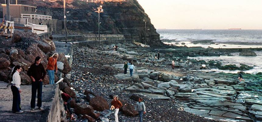
The Newcastle Coastal Zone Management Plan 2018 prescribes the short and medium term actions to manage identified coastal hazards. With two distinct coastal environments, the Newcastle Coastal Zone Management Plan 2018 has two parts: Part A - Stockton and Part B - Coastline South of the Harbour.
You can read more about the work we have completed to manage the beach erosion on Stockton Beach as part of the Stockton Coastal Management Plan and work that is underway on the Southern Beaches Coastal Management Plan.
The NSW Coastal Planning Guideline: Adapting to Sea Level Rise provides guidance on how sea level rise and its impacts, including coastal erosion and flooding, are to be considered in land use planning and development assessment in NSW.
City of Newcastle has adopted the projected erosion hazard lines for Stockton for up to 2120 (present day, 2040, 2060 and 2120) as identified in the Stockton Beach Coastal Processes Study. These hazard lines are considered during development assessment.
Learn more about Coastal Management by watching these short videos with Dr David Wainwright, Coastal Engineer and Conjoint Lecturer at the University of Newcastle.
- Coastal structures (2mins 50secs) such as groynes, breakwalls and seawalls can all impact sand movement.
- Sand nourishment (2mins 38secs) is when you take sand from somewhere else and import it to give you a sandy beach for recreation or to provide more protection during erosion events.
- Sand movement (1min 29 secs) along the NSW Coast is mostly from south to north with both natural and artifical obstacles affecting the movement of sand.