Stockton Works Updates
In response to several severe weather events, emergency works were commenced to protect sections of the Stockton coastline most at risk of further erosion as we work through the development of a long-term strategy for Stockton Beach.
This work is ongoing and the Stockton community is provided with regular updates on the progress and status of this work. You can sign-up to the mailing list to receive this update by email.
The project map below outlines the most recent work at Stockton. You can also view a larger version of the map here.-WEB.jpg)
You can also find out more about repairs to the King Street breakwater and the new protection structures at the southern end of the Mitchell Street seawall.
Current beach access
- Lexie's: Open.
- Meredith Street: Open.
- Beeston Road: Open.
- Barrie Crescent (North from Griffith Avenue): Open.
- Dalby Oval / The Pines: Open
- King Street: Open.
- Little Beach: Open.
- Mitchell Street Seawall Stairs: Closed.
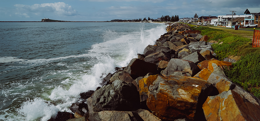
Care for our dunes
The continued use of closed accessways and jumping fences to walk over dunes is further damaging Stockton’s coastline. Vandalism, including intentional damage to rock bags unnecessarily puts our coastline at risk. Please respect work crews and follow any directional signage.
Beach scraping
City of Newcastle undertakes a regular program of beach scraping at Stockton Beach to help increase local dune resilience. This is an important part of our coastal management activities prior to the delivery of mass sand nourishment. Read more about beach scraping in the Beach Scraping Information Sheet.
Previous Updates
December 2023 (PDF)
April 2023 (PDF) - a printed copy of this update was delivered to all letterboxes across Stockton in April 2023.
March 2023 (PDF)
February 2023 (PDF)
December 2022 (PDF)
November 2022 (PDF)
October 2022 (PDF)
September 2022 (PDF)
August 2022 (PDF)
July 2022 (PDF)
June 2022 (PDF)
May 2022 (PDF)
April 2022 (PDF)
March 2022 (PDF)
February 2022 (PDF)
December 2021 (PDF)
November 2021 (PDF)